Some pictures from the weekend:

Showing posts with label Camping. Show all posts
Showing posts with label Camping. Show all posts
Wednesday, October 29, 2008
Backpacking and Halloween
This past weekend I didn't go kayaking, but I spent plenty of time outdoors. I took a Pierre Boy Scout troop backpacking in the Black Elk Wilderness area around Harney Peak. We started from Horse Thief Lake. On Friday night we hiked in a quarter of a mile or so and camped. On Saturday, we took the Horse Thief Trail south to Grizzly Bear Ck trail. Then we headed west to the Harney Peak trail. After coming back down from Harney, we continued north to the Willow Ck trail and then back east to Horse Thief Lake. A good time was had by all. I think we might end up doing a 50 miler sometime this spring or summer!It is looking like the high in Pierre will be in the 60s the next few days, so heres to hoping I get out onto the water! With Halloween on Friday, I might even take my pirate hat off the wall and wear it on the water! I'll be sure to get pics :)


Monday, October 13, 2008
Overnighter - Gavins Pt to Clay Co
Last night I got back from the south east corner of SD. On Friday, John Adler and I met down at the Chief White Crane State Rec. Area near Yankton. One bit of bad luck did occur; one of my tent poles developed a crack and the zipper on the door broke. After struggling with the zipper, I gave up and went into Yankton and picked up a tent at Walmart. Not the best expedition tent, but it performed well. The tent that had issues was a Wenzel. I am going to contact the company to get replacement parts, but I think I might start looking for the tent I really wanted when I bought it... a Kelty Grand Mesa 2.
Back to the trip. The forecast was for a decent Saturday but high wind advisories and likliness of thunderstorms convinced us to use the Clay County Rec. Area as our take out. Initially, we planned to camp at Bow Creek (undeveloped National Park Service land). We shuttled my pickup downstream at 7 AM, then got the boats loaded. We launched at 10AM.
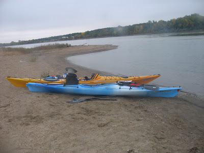 |
| From Missouri River - Gavins Pt to Clay Co |
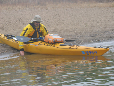 |
| From Missouri River - Gavins Pt to Clay Co |
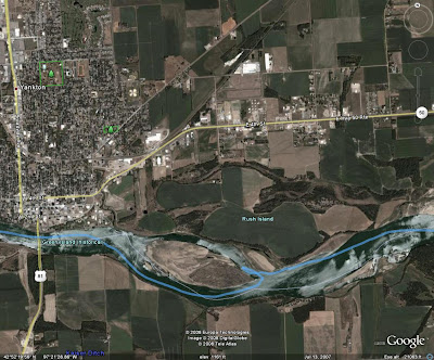 |
| From Missouri River - Gavins Pt to Clay Co |
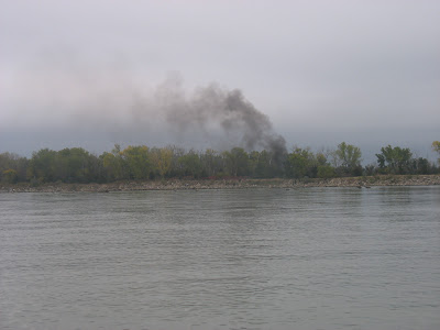
Just past Yankton, we ventured around the point of Rush Island to checkout something we saw and could not initially identify.
 |
| From Missouri River - Gavins Pt to Clay Co |
 |
| From Missouri River - Gavins Pt to Clay Co |
...And burned and pillaged whatever is beyond those trees ;)
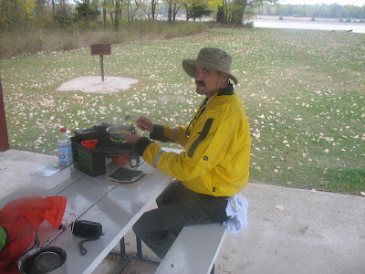
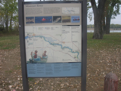
With the great time we were making downstream, we decided to stop at the St Helena boat access for lunch. And not a cold lunch either! We took the time to pull out our stoves and have a hot meal. I had beef ramen (reminiscent of my college days) and John had flavored rice.
 |
| From Missouri River - Gavins Pt to Clay Co |
 |
| From Missouri River - Gavins Pt to Clay Co |
 |
| From Missouri River - Gavins Pt to Clay Co |
 |
| From Missouri River - Gavins Pt to Clay Co |
On the upstream end of Goat Island, we beached our boats and explored a bit. The location was not great for setting up camp, but we were surprised to find a pickup camper mounted to a small trailer in amongst a somewhat heavily wooded area. Due to it's condition, it had been there awhile.
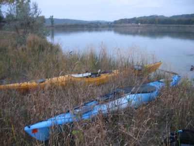
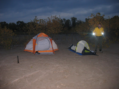
We continued along Goat Island until we found a suitable camp location. Our aerial photos helped significantly in this regard.
 |
| From Missouri River - Gavins Pt to Clay Co |
 |
| From Missouri River - Gavins Pt to Clay Co |
For supper, I had Dinty Moore Beef Stew and John had some Campbell's Chunky Soup among other things. I think we both slept well that night and were both up before sunrise. I had oatmeal for breakfast and John had a Mountain Dew. We were back on the water at sunrise.
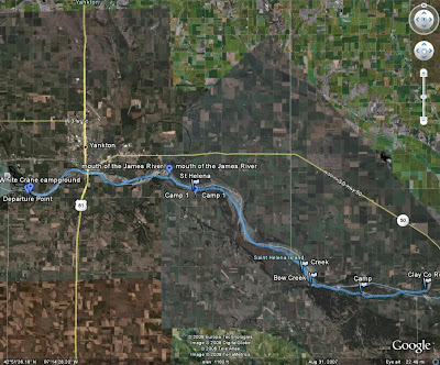
We were on the water for less than an hour before coming to the Clay County Rec. Area. We put 4 miles that morning, giving us a total of 28.7 for the trip.
 |
| From Missouri River - Gavins Pt to Clay Co |
A slide show of all of my pictures:
The short day on Sunday actually gave me time to visit my sister in Vermillion, catch my Panthers get smoked by the Bucs at Champs in SF, and get home before too late. What this trip did though is pump me up to do more like trips. For example:
- Gavins Point to Ponca State Park
- Fort Randall to Running Wate
- Hwy 34 to Hwy 63 (Cheyenne River) I did this one by canoe when I was in Jr High.
- Possibly a section of the Minnesota River
- Water Trails in MN
An excellent idea would be to have a SDCA cruise from Gavins Point to Ponca State Park. Anyone wanting to just paddle a portion of it could find another take out easily.
ADDED: A slideshow of the pictures John Adler took.
Wednesday, September 24, 2008
Yankton to Vermillion
With just over 2 weeks until the big trip on the Missouri River from Gavin's Point to Vermillion (subject to change), I am posting the current plan of action with contingencies.Currently, there are three people committed to the trip, John Adler, Arnold Lund, and myself. I have heard from two interested people through the power of the Internet, but I am not sure on their decision. Arnold might not get up to White Crane until late Friday evening (unless he flexes that week). So it might be up to John and I to shuttle vehicles or wait until Saturday morning (with the short distances that might be an idea). If we shuttle John's Chevy Tracker on Friday evening, I could have my sister move my pickup down to the take out though she probably couldn't get to it until Sunday. Final shuttling options will be decided Friday (October 10) evening.For anyone wanting to join us, we will be camping at Chief White Crane State Recreation Area on Friday evening. Look for the kayaks.
The plan is for everyone to carry their own gear and rations. Between John and I, we are supplying Arnold with gear for the trip. I plan on having numerous 1L bottles of water for the trip. That should be plenty for me. I might procure some more bottles or try to rig a way to carry a 2 gal. jug along too. No such thing as extra water. I plan on taking instant oatmeal, ramen, canned stew, trail mix, granola bars, and of course coffee along.
The trip itself has few changes. Distances are all from Gavins Point. First distance is measured in Google Earth, second is from the SDGFP/NPR.
The plan is for everyone to carry their own gear and rations. Between John and I, we are supplying Arnold with gear for the trip. I plan on having numerous 1L bottles of water for the trip. That should be plenty for me. I might procure some more bottles or try to rig a way to carry a 2 gal. jug along too. No such thing as extra water. I plan on taking instant oatmeal, ramen, canned stew, trail mix, granola bars, and of course coffee along.
The trip itself has few changes. Distances are all from Gavins Point. First distance is measured in Google Earth, second is from the SDGFP/NPR.
- Meet up and camp Friday evening at Chief White Crane State Recreation Area.
- Shuttle vehicles either Friday evening or Saturday morning.
- Depart on the river.
- Mouth of the James River (9.5 miles) Possible side trip.
- St Helena Potential Campsite (11.25 miles) (12 miles)
- Bow Creek Potential Campsite (~21miles)
- Goat Island Potential Campsite (24 miles to upstream end)(26 miles)
- Goat Island Downstream end (26.5 miles)
- Clay Co Recreation Area Potential Take Out (28 miles)
- SD Hwy 19 Bridge Potential Take Out (33.75 miles) (35 miles)
- Vermillion River Potential Take Out (36 miles)
- Bolton Bend Potential Take Out (44 miles) (48 miles)
For good weather the trip is likely to take just two days with camping around Bow Creek or Goat Island, but other campsites are shown for the potential of high winds and rain, as well as, side trips distracting us. The plan is to say 3 day trip and if we finish sooner, oh well. Cell phone reception should be adequate along this section of the river too.
View Larger Map
Should be a great trip!
Friday, September 12, 2008
Missour River Camping Trip UPDATE
John Adler and I have decided to add contingencies to this trip. My sister is living in Vermillion while at grad school and John's wife and father-in-law will be camping near Yankton. Also, we will have decent cell phone coverage on the river.
When we reach St Helena, we will decide if we want to push for Goat Island on the first day. Dependant on how much side exploring we do as well as the weather conditions. We can also have my sister move my pickup further downstream if we want to lengthen the overall trip.
There is also a primitive campsite at Bow Creek, 1.5-2 miles upstream from Goat Island that we can use too.
A quick overview:
- Meet and Camp at Chief White Crane State Rec. Area on Friday, October 10.
- Shuttle vehicle(s) to the Clay Co. access.
- Depart on trip Saturday morning. Take time to explore shoreline. If passable, consider a brief cruise up the James River.
- Arrive at the St Helena Access and campsite. Make decision on if we camp at St Helena or push for Goat Island. Also, decide if we want to change the destinations from Clay Co. access to the access near the SD 19 bridge or the Bolton Bend. Make arrangements by cell phone to have shuttle vehicle(s) moved, if necessary.
- Eventually, arrive at Goat Island and camp. Take time to explore the island. John Adler says that there are geocaches on the island.
- Arrive at destination.
October Paddling and Camping
I have created a Google Map with departure and arrival points marked for my October trip.
View Larger Map
A slight adjustment to the schedule will be that when we reach the St Helena campsite we will have to decide whether to push on towards Goat Island or camp at St Helena. I also figure to explore the James River (if passable at the mouth). We should have cell phone signal along the way so any adjustments we make on the trip can be reported. We can also extend the last stretch of the paddle from the Clay Co boat ramp to the SD 19 bridge if so desired on the Friday before we depart.
Mileage info:
View Larger Map
A slight adjustment to the schedule will be that when we reach the St Helena campsite we will have to decide whether to push on towards Goat Island or camp at St Helena. I also figure to explore the James River (if passable at the mouth). We should have cell phone signal along the way so any adjustments we make on the trip can be reported. We can also extend the last stretch of the paddle from the Clay Co boat ramp to the SD 19 bridge if so desired on the Friday before we depart.
Mileage info:
Saturday, September 6, 2008
Paddling and Camping Trip
I am planning a paddling and camping trip from Gavins Point Dam to Vermillion over the Native American Day weekend in October. A guide can be found on the Nebraska Parks website. Anyone interested, please let me know so I can plan for you. Jarett, feel free to post this on the SDCA blog... the more the merrier!
Friday October 10, 2008
Meet at the Gavins Point Tailwaters campground.
Unload and setup camp.
Camp Friday night.
Saturday October 11, 2008
Paddle approximately 14 miles to campground and boat access near St Helena, NE.
Camp.
Sunday October 12, 2008
Paddle approximately 21 miles to Goat Island.
Monday October 13, 2008
Paddle 3-4 miles to boat access near Vermillion.
Load everything.
Retrieve vehicles left at Gavins Point.
Nice lunch in Yankton.
Head for home.
Personal Gear
personal clothing, etc. (jackets, warmer clothes, and splash gear will probably be nice to have along... could be quite cool)
boat/paddle (I will look into borrowing or renting extra boats once I know who will be going and might need one)
lifejacket (I should have plenty of extras)
water bottle, etc.
tent (I have one 2-3 person tent and access to another similar)
sleeping bag
sleeping pad, not necessary but nice (I have one and a cheap one can be picked up at most walmarts)
tarp for underneath tents (I have one and will get a second if the second tent is necessary)
pocket knife, multitool, etc.
Group Gear
camp stove/propane
matches/firestarter/etc
mess kit/cooking kit
garbage bags (we'll have to carry our trash out)
multiple soft coolers
first aid kit
camp shovel
toilet paper
Menu
water
coffee
ramen
ring bologna (the idea is any meat should be precooked; I can be a little paranoid aboud keeping raw meat cold)
potatoes?
oatmeal
trail mix/granola bars/dried fruit
canned beans and/or veggies (maybe some canned hash?)
possibly some beer could end up along :)
Subscribe to:
Posts (Atom)