Monday, June 29, 2009
Saturday, June 27, 2009
Bad River Rendeavous
Today was again windy. I talked Chuck into taking an excursion up the Bad River. And what a day to do it! We made it further up the river than I have ever been! We totaled 7.4 miles.


Another after work paddle...
Yesterday (Friday) I went out paddling from the causeway. It was a bit windy, so I continued around the island and played in the big waves some as I paddled downstream. Nothing to special. I wish I could take pictures while I was playing in the waves; maybe someday I will have someone stand on shore and photograph the fun.

Sunday, June 21, 2009
Another La Framboise Circumnavigation


Saturday, June 20, 2009
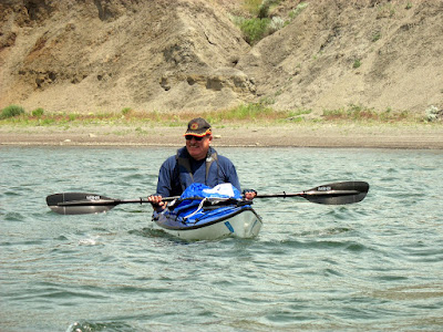
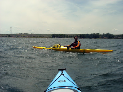
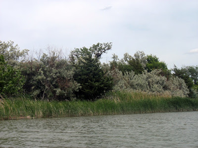
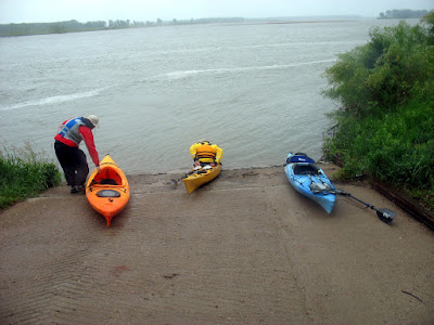
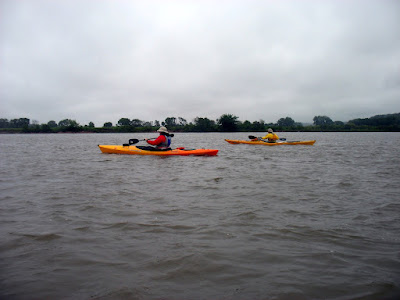
Pierre SDCA Cruise
The turn out for the first SDCA event in Pierre was low, but the fun and enjoyment factors were enormous. Just one soul, Ryan S., came up from the south eastern part of the state. We also had another Pierre paddler meet us at the put-in, Dave P. Btw, Dave paddles a skin of frame boat he built with Rick Johns.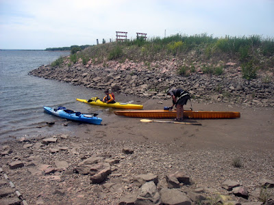

It ended being an excellant trip, though probably too windy for some. We covered 10.5 miles and had a great time. 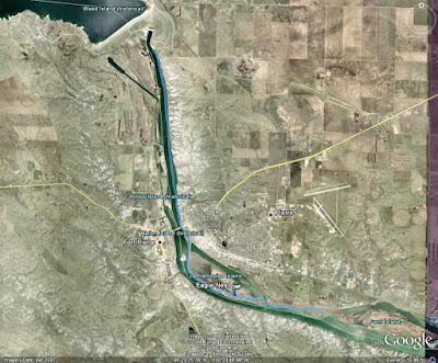
A slideshow of all of the pictures I took:
The temperature was in the mid 80s, but we had a SE wind ranging from 14-20 mph with gusts in the mid 20s (NOAA). The wind provided us a bit of fun coming around La Framboise. Our bows were crashing into the waves and I know at least two of the subsequent splashes came over my head! Ryan said something to the extent that this portion of the cruise was enough to make his whole trip worth it!
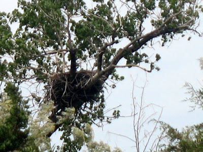
For a reprieve from the wind, we took the channel alongside La Framboise Island. Part of the island trail system is blocked off to try to keep a pair of eagles from abandoning their nest. Well, we managed to catch a glimpse of the nest as we paddled along.
Wednesday, June 17, 2009
Upstream
It was beautiful after work today. The temperature was in the low to mid 80s, the wind was essentially nonexistant, and the humidity was below 40%. Obviously, I had to get out on the river. I put in from the causeway. I noticed that quite a few people fishing from the riprap and the dock today. Also, the dam must have been releasing water, because most of shore of Discovery island (near the causeway boat ramp) was submerged.
I chose to head upstream and it was tough paddling against the release from the dam. I struggled to keep at 3 mph. With the water high, I took a short detour to check out Whiskey Gulch. What little there is of it anyway. I paddled to the island upstream of the bridges. On my way back downstream, I noticed that the sandbar upstream of the bridges is completely submerged with at least a foot of water. The route ended up being 4.4 miles and I easily clocked 6 mph on my way downstream.

I manged to take a couple of nice pictures of the railroad bridge on my way downstream. 

The weather is looking good for Saturday. NOAA is saying sunny with the high near 88 and winds 10-20 mph. Check out the below post for more on the SDCA cruise in Pierre on Saturday, June 20th. I have heard from only one paddler and John Adler is leaving on vacation on Friday.
Tuesday, June 16, 2009
SDCA in Pierre on Saturday
Let's plan to meet at the put in at noon on Saturday (June 20th). Directions here.
Saturday, June 13, 2009
Farm Island
I took a paddle around Farm Island this afternoon. It was a beautiful afternoon, low winds and a high in the low to mid 80s. I put in at the upstream boat ramp near the polo fields and paddled around the island, back past the beaches and campground. I took out on a beach behind some campsites and walked the quarter mile or so back to the launch point to fetch my pickup. The trip totaled 6.5 miles.
There was one other kayak on the water, a tandem, and a paddle boat. I also noticed 3 or 4 kayaks and 2 canoes on shore at the campground. 
Click any of the pictures to visit the full album. 
Don't forget, SDCA event in Pierre next Saturday, June 20th.
La Framboise Island
I went for a paddle around La Framboise Island after work yesterday. Nothing too eventful. I took a slight;y different path. I stayed outside the little channel until just before the dike. The distance was a little shorter today, 5.7 miles. Probably due to a more direct path. A few decent scenery pictures, one pelican, a couple shots of the dike, and a couple of the river traffic. The river traffic is starting to pickup, low June temps have made it later this year than in the past.
Friday, June 12, 2009
Next SDCA Event: June 20
View June 20 in a larger map
Launch from near the dam and cruise south to Farm Island. The cruise could be modified in route to include a jaunt up the Bad River and/or through the chute/channel alongside La Framboise Island. The route is 10.5 miles to the first Farm Island boat ramp. An option could be to continue another 6 miles around Farm Island, past the 2nd boat ramp, and take out along a sandy beach only a quarter mile walk from the first boat ramp. Depending on the turnout, we can adjust this plan or even go up onto Oahe instead.
Note that the take-out is at Farm Island State Rec. Area, so a state park sticker is required or $6/day.
Nearby Campgrounds can be found on http://www.campsd.com Oahe Downstream is the closest to the put-in and Farm Island is the take-out. Also, Griffin Park in Pierre offers free tent camping and has some camper hookups for $15/night. As for motels, there are quite a few in town. I have no idea which have the best deals. Another note, the same weekend is Oahe Days in Pierre. There will be a free concerts Friday and Saturday nights. Judd Hoos on Friday and Black Water Band on Saturday. Also, Steamboat will be having free kayak rentals on Saturday and Sunday.
I am going to suggest a meet up time at 12:00 PM. I am going to be running in a 5k in the morning so much earlier won't work for me. Either the put in or take out would make a good place to meet. I'll post where to meet sometime next week. Also, my cell # is 6 0 5 2 2 2 7 4 4 7 for anyone with questions, etc. You can also email me or leave a comment on my blog.
Sunday, June 7, 2009
Missouri River - Mulberry Bend to Bolton's Bend
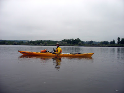
Despite the cancellation of the Missouri National Recreational Water Trail cruise, John and I decided to go down anyway. From the forecast, we thought there would be a window of opportunity. We had initially wanted to try to also go from Clay Co. Rec. Area to Mulberry Bend to fill the hole from our trip last October. But we decided to not risk the "window" any further. Also, I had a friend come up from Lincoln, NE to paddle with us. I borrowed a WS Pamlico 14 from another friend for him to use.
View MR Mulberry to Bolton in a larger map

Taking it easy... 
Nice view. 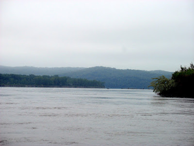
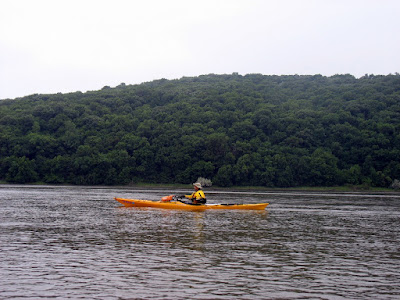
We doing alright! 
Whew, finishing up... what a day! 

The next SDCA event will be in Pierre on June 20. I have a couple of ideas, first from the dam down to Farm Island which is 10-16 miles depending on which end of Farm Island. We could also try Lake Oahe. What we ultimately do will depend upon who and how many paddlers attend. If you plan to attend, leave a comment on my blog or email me; let me know if there is a specific route that interests you too. I'll decide on a route and place to meet based upon responses I get. Thanks. There are plenty of places to camp around Pierre; also, this is the same weekend as Oahe Days in Pierre. There will be live bands playing in Steamboat Park on Friday (19th) and Saturday (20th) evenings. For anyone leary of carrying their boat from the SF area to Pierre, Steamboat will have free kayak rentals for Oahe Days. Hope to see everyone on the water!
View MR Mulberry to Bolton in a larger map
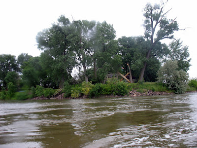
I found two significant places to specifically mention. First of all, we passed the mouth of the Vermillion River. Someone has a house right at the mouth and I couldn't help but imagine the benefits to it.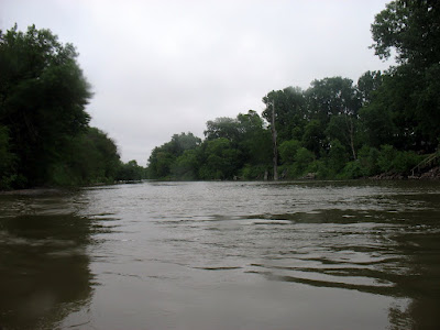
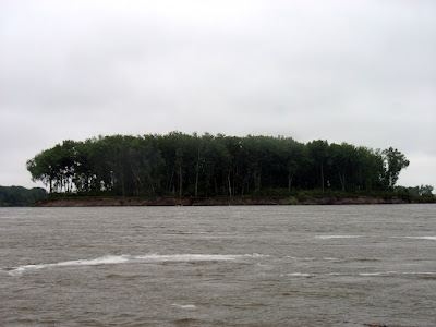
Not long after passing the mouth of the Vermillion we began to approach a wooded island. I have not found a name for the island though.Brule Creek
Despite the event being cancelled, John and I decided to go down and paddle the Missouri River from Mulberry Bend to Bolton's Bend anyway. From multiple forecasts we thought there would be a window of opportunity, but more on that later.
View brule creek in a larger map


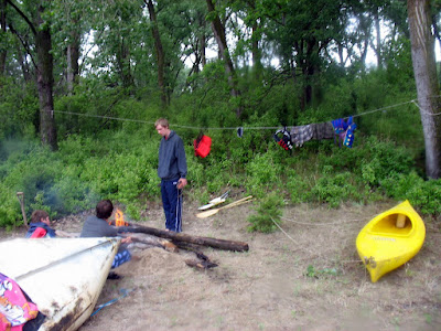
I was camping at Union Grove Rec. Area. While I was waiting for a friend from Lincoln, NE to join me, I decided check to see if nearby Brule Creek was paddlable.
View brule creek in a larger map
Subscribe to:
Posts (Atom)