 |
Subscribe to Pierre Paddlers |
Email: |
Visit this group |

Showing posts with label Pierre Kayak Club. Show all posts
Showing posts with label Pierre Kayak Club. Show all posts
Thursday, March 4, 2010
Pierre Paddlers
Any locals to the Pierre - Ft Pierre, SD area that happen to paddle kayaks, canoes, or whatever, please join the email group I set up through Google. John Adler has moved (though still trying to sell his house) to Hot Springs, SD to run a KOA campground. Instead of taking over his Kayak Club Yahoo group, I decided to create my own because I prefer Google and I liked the idea of including all paddle sports in the name. The idea is to share when and where you play to go paddling so other members can join you if they want.


Saturday, June 27, 2009
Bad River Rendeavous
Today was again windy. I talked Chuck into taking an excursion up the Bad River. And what a day to do it! We made it further up the river than I have ever been! We totaled 7.4 miles.


Sunday, June 7, 2009
Missouri River - Mulberry Bend to Bolton's Bend
Despite the cancellation of the Missouri National Recreational Water Trail cruise, John and I decided to go down anyway. From the forecast, we thought there would be a window of opportunity. We had initially wanted to try to also go from Clay Co. Rec. Area to Mulberry Bend to fill the hole from our trip last October. But we decided to not risk the "window" any further. Also, I had a friend come up from Lincoln, NE to paddle with us. I borrowed a WS Pamlico 14 from another friend for him to use.
View MR Mulberry to Bolton in a larger map
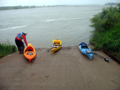
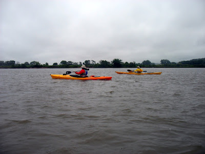
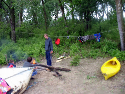

Taking it easy... 
Nice view. 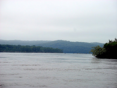
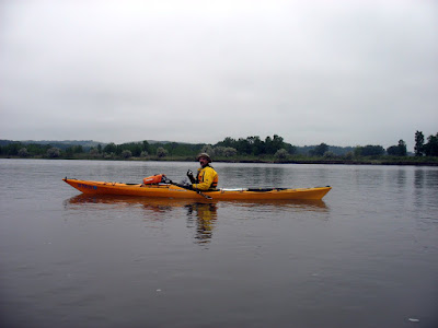
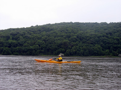
We doing alright! 
Whew, finishing up... what a day! 

The next SDCA event will be in Pierre on June 20. I have a couple of ideas, first from the dam down to Farm Island which is 10-16 miles depending on which end of Farm Island. We could also try Lake Oahe. What we ultimately do will depend upon who and how many paddlers attend. If you plan to attend, leave a comment on my blog or email me; let me know if there is a specific route that interests you too. I'll decide on a route and place to meet based upon responses I get. Thanks. There are plenty of places to camp around Pierre; also, this is the same weekend as Oahe Days in Pierre. There will be live bands playing in Steamboat Park on Friday (19th) and Saturday (20th) evenings. For anyone leary of carrying their boat from the SF area to Pierre, Steamboat will have free kayak rentals for Oahe Days. Hope to see everyone on the water!
View MR Mulberry to Bolton in a larger map
I found two significant places to specifically mention. First of all, we passed the mouth of the Vermillion River. Someone has a house right at the mouth and I couldn't help but imagine the benefits to it.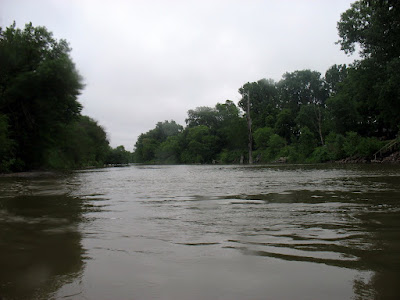
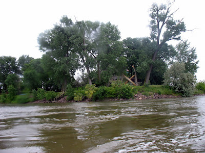
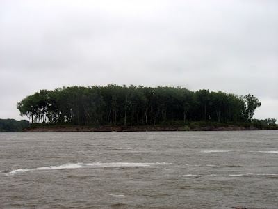
Not long after passing the mouth of the Vermillion we began to approach a wooded island. I have not found a name for the island though.Saturday, May 30, 2009
Peoria Flats to East Shore
John and I have completed another section of Lake Oahe. We met at the East Shore boat ramp, loaded my boat and gear onto John's Tracker and headed for Peoria Flats. Until recently, the Peoria Flats has been high and dry. The recently submerged trees reminded us of the movie Deliverance.
We ended up paddling 5.5 miles from Peoria Flats to East Shore. It turned out to be a beautiful day and we wished we had chosen a longer stretch, like Spring Creek to Peoria Flats or around Little Bend. 
Launching from Peoria Flats. 
Slideshow:
Monday, May 25, 2009
A full crew!
It wasn't a beautiful afternoon, but it proved acceptable. Chuck, John, and I met at the causeway at 2 PM. We began paddling upstream against the wind and the current. It was tough going. When we stopped paddling, we would lose ground! After about 40 minutes, Chuck turned back so that he could meet up with his daughter. John and I pushed on to a small island. It took us an hour to reach the island and only half an hour to get back. We ended up covering 4.5 miles.

Fighting the wind.


What? The wind stopped once we turned around!
Wednesday, May 13, 2009
An Evening At Farm Island...
Yesterday evening John and I decided to go out for a paddle. Because of the possibility of storms and the wind picking up, we chose to paddle alongside the Pierre side of Farm Island. That way we had some where to come ashore if the weather got bad too soon. We ended up covering 5.7 miles. The wind picked and switched direction on our way back from the tip of Farm Island; we could also see lightening in the distance, but we only had a few sprinkles fall on us. And we were off the water soon after.
John letting his wife know we are heading back.
Pretty cool looking...
 |
| From 2009_05_12 |
 |
| From 2009_05_12 |
 |
| From 2009_05_12 |
 |
| From 2009_05_12 |
Saturday, May 9, 2009
Okobojo Point
I drove up to Okobojo Point, where John was camping, to go paddling this afternoon. This was my first endeavor onto Lake Oahe. Luckily the wind stayed down for the most part. We headed in a westerly direction; this part of the lake is a bend that runs east-west. We paddled about 3 miles to a point where John hid a geocache and then returned to the campground. We covered a total of 5.8 miles. The map below looks like we paddled over land, but I think the aerial photo was taken when the water level was down.
View 09-MAY-09.kmz in a larger map
View 09-MAY-09.kmz in a larger map
Sunday, April 19, 2009
Into Farm Island
The temperture was in the mid 60s and the wind was under 15 mph so John and I decided to go paddling. We met at the main Farm Island boat ramp and paddled into the interior of the island. Nothing much else to report. We covered 3.9 miles.
Tuesday, April 14, 2009
April A La Framboise
After work yesterday, John and I decided to take a cruise around La Framboise Island. It was a beautiful day for a paddle; the high was 65 degrees and the the wind was calm. We covered 5.75 miles.
 |
| From 2009_04_13 |
The water was almost too low to sneak through the "island channel" but we persevered. We did have to use our hands to help get over a fallen tree and the dike, but we remained in our boats.
 |
| From 2009_04_13 |
Slide show of the pictures I took; including a few of pelicans.
Saturday, April 11, 2009
April
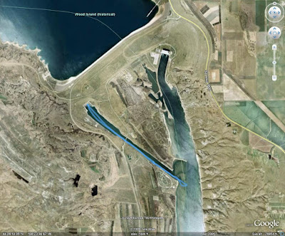
Yesterday afternoon I went for my first paddle of April this year. John had his RV at the Oahe Downstream campground (notice I did not say he was camping) so I met him and a couple of newbie paddlers that Chuck coerced into the hobby. Not to much to say, we paddled up the stilling basin to the dam, then down to the main channel, then back to the rocky beach by the campsites. Totaled appoximately 4 miles.
"So, what time was the dam going to release water?"
 |
| From 2009_04_10 |
 |
| From 2009_04_10 |
 |
| From 2009_04_10 |
 |
| From 2009_04_10 |
 |
| From 2009_04_10 |
 |
| From 2009_04_10 |
Saturday, March 28, 2009
Bad River Expedition
John and decided to go for a paddle today; Chuck couldn't make it. We decided to give the Bad River a try since it is now ice free. We ended up traveling the to the furthest point upstream I have ever been too; I was there once last spring too.
Oh yeah, here is proof that I made it this far up the Bad River before.
 |
| From 2009_03_28 |
 |
| From 2009_03_28 |
 |
| From 2009_03_28 |
We ended up covering our longest stretch of 2009... 7.5 miles and I have made it out 5 times in the month of March. And the slideshow of all the pictures I took today.
Sunday, March 8, 2009
Second March Paddle
The weather gods sure have been fickle lately. The forecast for Friday was mid 40s but John and I were lucky to have 30 degrees. This weekend was forecast to be much colder and snowing, but today was sunny and the high was 53 according to NOAA. John and I met at the causeway at 2:30 PM and began to paddle down stream along La Framboise Island. On the return trip we came across Chuck, who couldn't make it at 2:30 PM. We then all headed back to the causeway. John and I had about 4.5 miles and Chuck was close to 1.5 miles. Some pictures below.
Boarding Party:


Friday, March 6, 2009
March
Well, I wanted to get out paddling on Wednesday when the temperature broke 50 degrees and the wind was miniscule, but neither John nor Chuck were game. I couldn't make it out on Thursday due to a seminar at work. But as of Thursday, today was supposed to reach the mid 40s, so John and I planned to take time off to go paddling. As the morning progressed and the temperature held around 32 degrees I was getting worried. But John and I, being the hardy South Dakotan's that we are, chose to go out anyway. Besides, this weekend is only going to be worse weatherwise. We met at 2:30 at the causeway and as we prepared to launch, John checked the temperature and it had DROPPED 2 DEGREES.! I think the temperature was 29 - 30 degrees while we were on the water. But John got his 24th straight month in and we both experienced something new... ice forming on our paddles, paddle leashes, and other gear! We ended up paddling for about an 1 hour, 20 minutes and covered about 3.5 miles. Some pictures below.
Sunday, February 8, 2009
Two
Wow, I went paddling once during the first month of the new year. Today I made it twice for February! Hopefully I do better than this later this summer :)
Well, today I went paddling with Chuck since he missed out on Thursday. Nothing much to report. The officicial high was 50 degrees (NOAA) and the wind was 18 mph. Almost too windy for a winter paddle, but it wasn't too bad on the water. Only occasional white caps (not continuous).
We didn't do much. We put in from the Ft Pierre boat ramp and paddled down to the Bad River, then crossed over to La Framboise Island and paddled up towards the highway bridge, bacl over to the Ft Pierre side and downstream to the ramp. We were on the water close to an hour.
A few pictures from the outing:
Thursday, February 5, 2009
February Paddlin' Hooky
The forecast for today was close to 50 degrees and calm, so John Adler and I took annual leave to go out paddling. It was a gorgeous day to be on the river. The high hit 54 around 3pm according to NOAA. John measured the water temp as being 34-35 degrees. We took off from the causeway and headed downstream along La Framboise Island breaking small chunks of ice along the way. The small channel running between the island proper and a sand bar was, obviously, iced in... as well as the Pierre side of the island. After reaching the end of the island we turn about and headed back. We spent nearly 3 hours on the water and traversed roughly 6.8 miles (my gps read 6.7 and John's read 6.9). In all, it was a great day for paddling!
John's pictures:
 |
| From 2009_02_05 |
John's pictures:
Sunday, January 11, 2009
Winter Paddling
Just a quick post to make the eastern SD readers of my blog jealous. The Pierre Kayak Club got on the water this afternoon. I am not sure how far we went but we spent about an hour on the water. I can't find any confirmation of it, but the temperature was in the mid to low 30s. The weather sites had said a high of 36-38, but NOAA claims we never hit 30. Oh well.
A few pics:
A few pics:
Monday, November 3, 2008
November Paddling
I went kayaking on both Saturday and Sunday, though on Saturday I forgot to grab my camera and gps on the way out of my apartment. Hopefully, I can get John Adler's pictures from Saturday, until then, here are my pictures from Sunday. We went around La Framboise Island, starting at the Legion and heading upstream on the river side to the causeway.
Sunday, October 19, 2008
Twin Bridges to DeGrey
Yesterday the "Pierre Kayak Club" did another section of the Missouri River near Pierre. This time we tackled from Twin Bridges to DeGrey.
View Larger Map
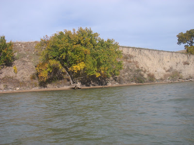
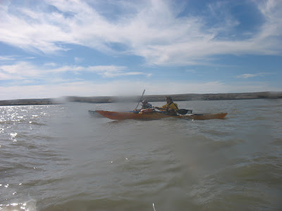
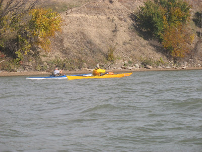
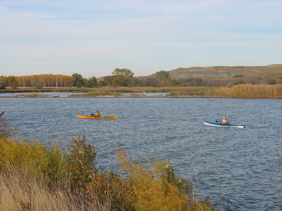
Not too much else to say about the trip. I have a few pictures of foliage, but mostly of Chuck and John. Not too much to see on this stretch.
 |
| From 2008_10_18 |
 |
| From 2008_10_18 |
Look at the "air" under John's boat.
 |
| From 2008_10_18 |
 |
| From 2008_10_18 |
Subscribe to:
Posts (Atom)