“Spend as much time as possible on mountains, in small boats, or otherwise out in the weather; if you never get wet, cold, exhausted or scared, you won’t properly appreciate being dry, warm, rested and safe.” ~ Peter Jay

"I’m an adventuring river rat at heart. Put me on a floating piece of driftwood and I’m happy." ~ Christina Glauner

"There’s folly and foolhardiness on one side and daring and calculation on the other." ~ C.S. Forester's Horatio Hornblower novels

Wednesday, September 24, 2008

Yankton to Vermillion

With just over 2 weeks until the big trip on the Missouri River from Gavin's Point to Vermillion (subject to change), I am posting the current plan of action with contingencies.Currently, there are three people committed to the trip, John Adler, Arnold Lund, and myself. I have heard from two interested people through the power of the Internet, but I am not sure on their decision. Arnold might not get up to White Crane until late Friday evening (unless he flexes that week). So it might be up to John and I to shuttle vehicles or wait until Saturday morning (with the short distances that might be an idea). If we shuttle John's Chevy Tracker on Friday evening, I could have my sister move my pickup down to the take out though she probably couldn't get to it until Sunday. Final shuttling options will be decided Friday (October 10) evening.For anyone wanting to join us, we will be camping at Chief White Crane State Recreation Area on Friday evening. Look for the kayaks.
The plan is for everyone to carry their own gear and rations. Between John and I, we are supplying Arnold with gear for the trip. I plan on having numerous 1L bottles of water for the trip. That should be plenty for me. I might procure some more bottles or try to rig a way to carry a 2 gal. jug along too. No such thing as extra water. I plan on taking instant oatmeal, ramen, canned stew, trail mix, granola bars, and of course coffee along.
The trip itself has few changes. Distances are all from Gavins Point. First distance is measured in Google Earth, second is from the SDGFP/NPR. 
  1. Meet up and camp Friday evening at Chief White Crane State Recreation Area.
  2. Shuttle vehicles either Friday evening or Saturday morning.
  3. Depart on the river.
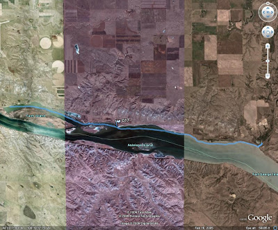
  4. Mouth of the James River (9.5 miles) Possible side trip.
  5. St Helena Potential Campsite (11.25 miles) (12 miles)
  6. Bow Creek Potential Campsite (~21miles)
  7. Goat Island Potential Campsite (24 miles to upstream end)(26 miles)
  8. Goat Island Downstream end (26.5 miles)
  9. Clay Co Recreation Area Potential Take Out (28 miles) 
  10. SD Hwy 19 Bridge Potential Take Out (33.75 miles) (35 miles)
  11. Vermillion River Potential Take Out (36 miles) 
  12. Bolton Bend Potential Take Out (44 miles) (48 miles)
For good weather the trip is likely to take just two days with camping around Bow Creek or Goat Island, but other campsites are shown for the potential of high winds and rain, as well as, side trips distracting us. The plan is to say 3 day trip and if we finish sooner, oh well. Cell phone reception should be adequate along this section of the river too. 
View Larger Map
Should be a great trip!

Friday, September 19, 2008

Arrr, Don't ye be forgettin' International Talk A Pyrate Day!

Arrr, Don't ye be forgettin' International Talk A Pyrate Day!

Sunday, September 14, 2008

Farm Island to Twin Bridges

Yesterday the Pierre Kayak Club took a cruise from the Farm Island beach to twin bridges. Twin bridges is the name that locals call the point where Medicine Creek empties into the Missouri River. There are two highway bridges at the location; one overpasses the railroad as it turns away from the river and the other crosses the creek/river. There is also a third bridge where the railroad crosses the creek.
From 2008_09_13
My gps read that I covered 11 miles on the day, though after 4.5 miles we got an extended break. A thunderstorm blew in and we had to wait approximately 30 minutes on the shore for it to pass. Luckily we had splash jackets with us... and John and I learned that spray skirts do a decent job protecting our pants in a rainstorm! Chuck found a second use with his pop up sail... as an umbrella! After we got underway again the going was fast, though difficult for John and I. We were with the wind, but we had to fight to keep from being windcocked. Chuck started playing with his sail... and his rudder kept him straight. Though I did hit 7 mph keeping up with Chuck!
Along the way we didn't see much for wildlife... they knew the storm was coming better than the weathermen? We did see a seagull or two and a great blue heron. A slideshow of my pictures is below... just click the slideshow to see the albulm at Google's Picasaweb.

Friday, September 12, 2008

Missour River Camping Trip UPDATE

John Adler and I have decided to add contingencies to this trip. My sister is living in Vermillion while at grad school and John's wife and father-in-law will be camping near Yankton. Also, we will have decent cell phone coverage on the river.
When we reach St Helena, we will decide if we want to push for Goat Island on the first day. Dependant on how much side exploring we do as well as the weather conditions. We can also have my sister move my pickup further downstream if we want to lengthen the overall trip.
There is also a primitive campsite at Bow Creek, 1.5-2 miles upstream from Goat Island that we can use too.
A quick overview: 
  1. Meet and Camp at Chief White Crane State Rec. Area on Friday, October 10.
  2. Shuttle vehicle(s) to the Clay Co. access.
  3. Depart on trip Saturday morning. Take time to explore shoreline. If passable, consider a brief cruise up the James River.
  4. Arrive at the St Helena Access and campsite. Make decision on if we camp at St Helena or push for Goat Island. Also, decide if we want to change the destinations from Clay Co. access to the access near the SD 19 bridge or the Bolton Bend. Make arrangements by cell phone to have shuttle vehicle(s) moved, if necessary.
  5. Eventually, arrive at Goat Island and camp. Take time to explore the island. John Adler says that there are geocaches on the island.
  6. Arrive at destination.

October Paddling and Camping

I have created a Google Map with departure and arrival points marked for my October trip.


View Larger Map

A slight adjustment to the schedule will be that when we reach the St Helena  campsite we will have to decide whether to push on towards Goat Island or camp at St Helena. I also figure to explore the James River (if passable at the mouth). We should have cell phone signal along the way so any adjustments we make on the trip can be reported. We can also extend the last stretch of the paddle from the Clay Co boat ramp to the SD 19 bridge if so desired on the Friday before we depart.
Mileage info:

Sunday, September 7, 2008

Football Sunday Paddle

I went out paddling this morning after church but before kickoff of any football games. It was a nice paddle around Dump Island, about 3.7 miles. I used my new paddle; an Onno paddle and I really enjoyed it. It is definatly lighter than my Bending Branches Slice Carbon Plus. Similar power, maybe a little more I need to paddle with it more to know for certain.


The day turned out even better after Jake Delhomme's last second TD pass to Dante Rosario. Go Panthers!

Saturday, September 6, 2008

Paddling and Camping Trip

I am planning a paddling and camping trip from Gavins Point Dam to Vermillion over the Native American Day weekend in October. A guide can be found on the Nebraska Parks website. Anyone interested, please let me know so I can plan for you. Jarett, feel free to post this on the SDCA blog... the more the merrier!
Friday October 10, 2008
Meet at the Gavins Point Tailwaters campground.
Unload and setup camp.
Camp Friday night.
Saturday October 11, 2008
Paddle approximately 14 miles to campground and boat access near St Helena, NE.
Camp.
Sunday October 12, 2008
Paddle approximately 21 miles to Goat Island.
Monday October 13, 2008
Paddle 3-4 miles to boat access near Vermillion.
Load everything.
Retrieve vehicles left at Gavins Point.
Nice lunch in Yankton.
Head for home.
Personal Gear
personal clothing, etc. (jackets, warmer clothes, and splash gear will probably be nice to have along... could be quite cool)
boat/paddle (I will look into borrowing or renting extra boats once I know who will be going and might need one)
lifejacket (I should have plenty of extras)
water bottle, etc.
tent (I have one 2-3 person tent and access to another similar)
sleeping bag
sleeping pad, not necessary but nice (I have one and a cheap one can be picked up at most walmarts)
tarp for underneath tents (I have one and will get a second if the second tent is necessary)
pocket knife, multitool, etc.
Group Gear
camp stove/propane
matches/firestarter/etc
mess kit/cooking kit
garbage bags (we'll have to carry our trash out)
multiple soft coolers
first aid kit
camp shovel
toilet paper
Menu
water
coffee
ramen
ring bologna (the idea is any meat should be precooked; I can be a little paranoid aboud keeping raw meat cold)
potatoes?
oatmeal
trail mix/granola bars/dried fruit
canned beans and/or veggies (maybe some canned hash?)
possibly some beer could end up along :)